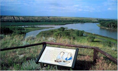
When they reached this point they had to decide which was the main branch that would take them to the Rockies. The map Jefferson had supplied, published in London three years earlier with information supplied by the Hudson's Bay Company didn't answer the question.
The north Fork was muddy like the Missouri they had been on, so most of the men thought it the was the main stream. But the captains felt the river coming from the Rockies should be clearer. They set up camp at this point and spent 10 days exploring and deciding which way to go.